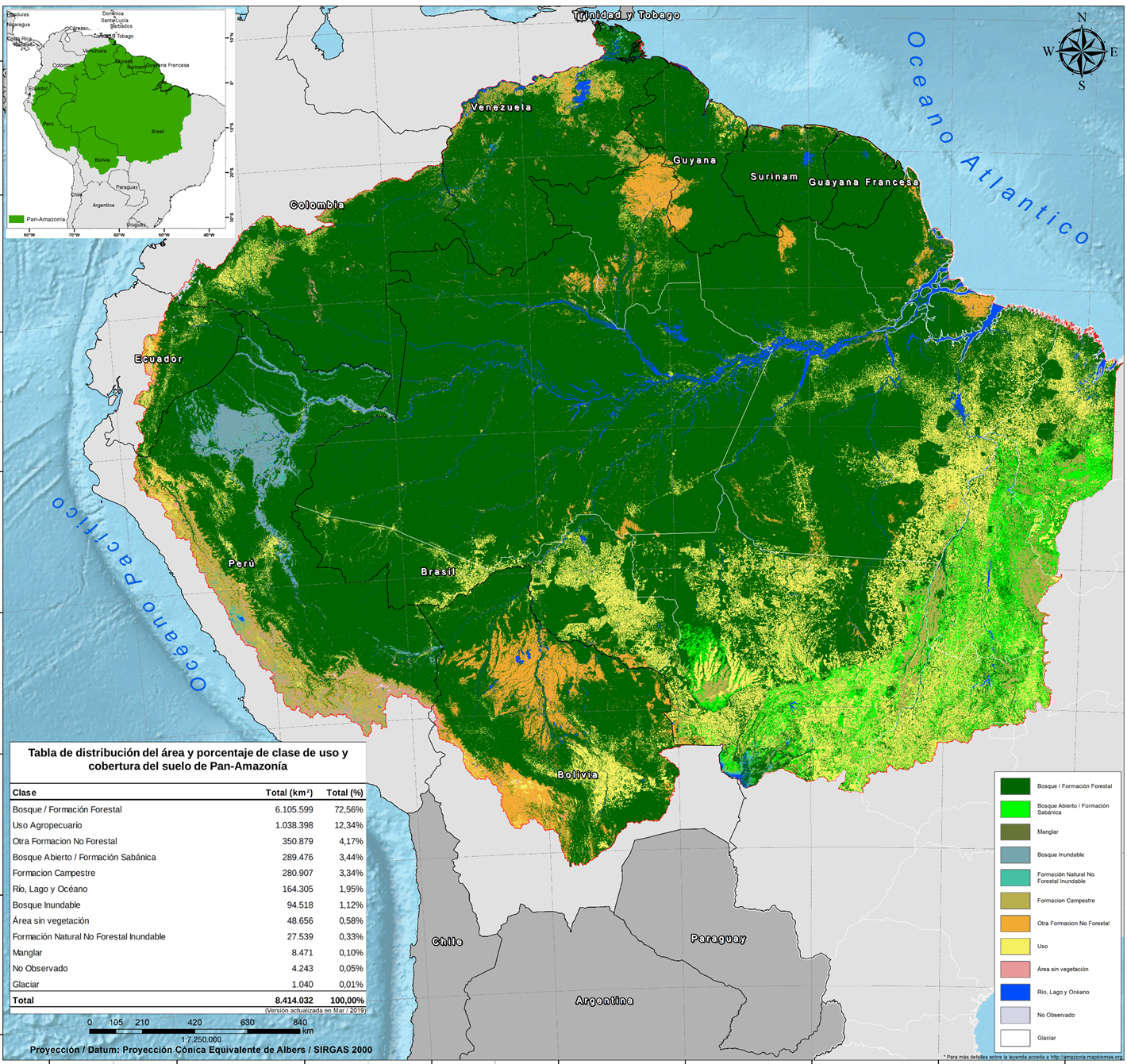
The Amazon lost in the last 17 years the equivalent rainforest to Ecuador territory

MapBiomas tool monitors the use of soil changes of the Amazon and follows the pressures over the rainforest. This new analysis covers 9 countries of the region, 21 types of soil cover and 6 biomes (Amazon, Cerrado, Marshland, Andes, Chaco-Chiquitano y Bolivian Tucumano).The obtained results point that during 2000 and 2017 period, and despite of conserving 85% of the native forests cover, the region lost 29,5 million hectares, a territory equivalent to Ecuador. On the other hand, during the same period there was a 41% growing of the agriculture and livestock area. This is the first mapping of the region compatible and standardized to every country, which allows to know the vegetation cover state, the tendencies and changes of soil use, like the substitution of forest by crops or pastures.

La encrucijada de los bosques colombianos

[vc_row][vc_column][vc_column_text] Publicado en: Semana 9 de marzo de 2019  [/vc_column_text][/vc_column][/vc_row][vc_row][vc_column][vc_column_text]A finales de 1880, colonos provenientes del interior del país llegaron a San Vicente del Caguán atraídos originalmente por la quina y el caucho. Luego de asentarse en el territorio y desplazar a los indígenas huitotos, tamas y koreguajes, los nuevos habitantes de la selva cambiaron…

Novo site do ISA apresenta raio-X de terras indígenas na Amazônia

Sistema de indicadores elaborado pelo Instituto Socioambiental lançado nesta segunda-feira (18), dá um panorama da situação das Terras Indígenas (TIs) na Amazônia Legal. O Terras + utiliza informações como presença de invasores ilegais, de projetos de infraestrutura e etapas de demarcação para avaliar a condição de 361 Terras Indígenas na região. Acesse o Terras +.