Dados cartográficos
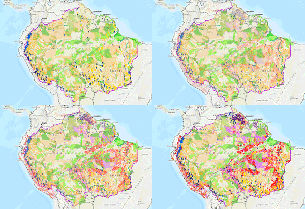
Visualização de informações geoespaciais sobre a Amazônia.

Informações geoespaciais sobre a Amazônia: territórios indígenas e áreas naturais protegidas, obras de infraestrutura, concessões e pedidos de exploração de recursos naturais.
A propriedade intelectual dos dados corresponde às fontes originais em cada país, descritas nos metadados. Podem ser fontes governamentais ou informações geradas por organizações membros da RAISG, ou mesmo outras organizações da sociedade civil.
A citação dos dados geográficos deve seguir a forma descrita no campo "citação" dos metadados de cada tema.
Leia mais em Termos de uso.
Mapa de áreas de prioridade chave (APC) para o estado de conservação na Amazonia
Os dados também podem ser acessados diretamente neste diretório RAISG: [ Clique aqui ]
| Cookie | Duração | Descrição |
|---|---|---|
| cookielawinfo-checkbox-analytics | 11 months | This cookie is set by GDPR Cookie Consent plugin. The cookie is used to store the user consent for the cookies in the category "Analytics". |
| cookielawinfo-checkbox-functional | 11 months | The cookie is set by GDPR cookie consent to record the user consent for the cookies in the category "Functional". |
| cookielawinfo-checkbox-necessary | 11 months | This cookie is set by GDPR Cookie Consent plugin. The cookies is used to store the user consent for the cookies in the category "Necessary". |
| cookielawinfo-checkbox-others | 11 months | This cookie is set by GDPR Cookie Consent plugin. The cookie is used to store the user consent for the cookies in the category "Other. |
| cookielawinfo-checkbox-performance | 11 months | This cookie is set by GDPR Cookie Consent plugin. The cookie is used to store the user consent for the cookies in the category "Performance". |
| viewed_cookie_policy | 11 months | The cookie is set by the GDPR Cookie Consent plugin and is used to store whether or not user has consented to the use of cookies. It does not store any personal data. |